Report of nine Centra government agencies and institutions.
Amit Pandey, Dehradun
A series of development projects including rampant tourism-related multi-storied buildings, highway widening and other construction for the Char Dham Project, and a 520 MW mega hydropower dam were undertaken in and around the town. The Tapovan Vishnugad project of NTPC involves the construction of a several kilometres-long underground tunnel in the wake of which severe damage to local geology, hydrology and landscape has been put on record, – claimed by Joshimath Bachao Sangharsh Samity.
Such developmental projects have put ecologically sensitive areas of the country, including the Himalayas, on the edge, the statement said, calling for protests and critique of dilution of environmental norms and infrastructure building that are insensitive to local terrain and the people’s needs.
The report of nine central government agencies and institutions – CBRI, IIRS, NIHR,GSI, CSRI, IIT Roorkee, Wadia Institute Of Himalyan Geology and Central Water Commission asserted the alert for the Joshimath infra project .
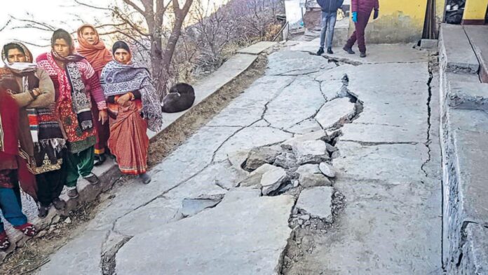
The report points out that ” the subsidence in the region may be due to the town – cutting phenomenon ( along Alaknanda river which flow at the toe/ base of Joshimath at hillside), slope instability as a result of seepage of local drainage water in the soil, terrain and edaphic characteristics ( relating to physical and chemical condition of the soil), loose and unconsolidated moraine materials of the slope ( due to old landslide) and flash flood events in and around the area in recent past. This has resulted in the development of cracks in the ground as well as houses in the Joshimath town.” The analysis found there was a sudden increase in deformation on November 9, 2022 and Nov 21, 2022, which continued up to January 19,2023.
The recent ground cracks are mostly aligned along a 50- 60 m width along NW – SE direction covering Sunil Gaon, Manohar Bagh, Singdhar, and Marwari wards. ” The cracks are not centrated in the area where heavy settlements are not present.” Excessive rate of water flow locally along a linear zone because of underground seepage lines within the overburden, coupled with an excessively heavy load of multi – storeyed civic structures on narrow and potentially unconsolidated debris mass are the main reasons for recent spurt in subsidence,” the report stated.
However last Wednesday, the state government submitted all nine reports prepared by Central agencies and institutions over Joshimath.


