Siang Dam: Himalayan Blunder in the Making?

 an hour ago
Aral Teaches None: A Cong idea, BJP Implementation
China's water ambitions cannot justify India's ecological gamble. Strategic security must not come at the cost of geological safety, indigenous lives and downstream survival.
The Himalayas are sending increasingly unmistakable warnings, but governments appear determined to hear only what suits their development and security agendas. Political differences are superficial, Siang like many other disastrous proposals, including the rudimentary demoetisation ideas germinated in the Congress-led UPA regime
The catastrophic collapse of rock and glacier ice near Langtang Lirung in Tibet-Nepal on August 26, 2026, demonstrated how a mountain disaster at an altitude of about 5,000 metres can turn into a devastating transboundary flood within minutes. Thousands of lives were lost, lakhs of fish and other fauna lostor remain unaccounted for.
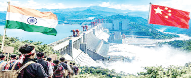
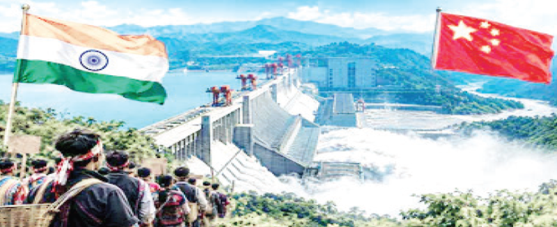
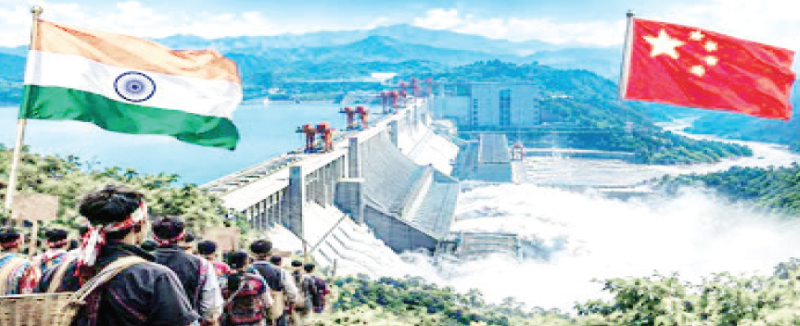
Yet India is considering another massive intervention in this fragile mountain system: the 11,200 MW Siang Upper Multipurpose Project in Arunachal Pradesh. Justified as a strategic response to China's proposed mega-60000MW dam at Medog, the project raises a fundamental question: can one Himalayan gamble be countered by another?
The mountain warning
The Langtang Lirung disaster was not an ordinary flood or a conventional glacial lake outburst flood (GLOF). A massive mass of rock and glacier ice detached from the mountain, plunged into the Lhende Khola and generated a cascading sequence of debris flows and floods through the Bhote Koshi and Trishuli river systems. The temporary blockage and subsequent release of water magnified the destruction.
Much of it is attributed to ratholed Himalayas by projects on the northern and southern side of the Himalayas by both India and China.
The International Centre for Integrated Mountain Development (ICIMOD) estimates that approximately 132 million cubic metres of rock and glacier ice detached. Satellite observations recorded ground deformation of up to 40 centimetres in the 48 days preceding the collapse. Its October 13 assessment reported at least 1,451 deaths and 5,745 missing in Nepal, apart from casualties in China.
Larger Tragedy
The lesson is larger than the immediate tragedy. Mountain hazards are no longer confined to familiar categories of landslides, cloudbursts or GLOFs. A collapsing mountain slope can temporarily dam a river, create an unstable reservoir and unleash a destructive surge downstream. Existing warning systems, largely designed around rainfall and river levels, may fail to detect such sudden geological events.
It is important, however, not to exaggerate the geographical impact. The August disaster affected the Bhote Koshi-Trishuli-Narayani river system; and devastate North Bihar, West Bengal and Bangladesh.
Lessons from the Aral Sea
There is another environmental warning from Central Asia. The Soviet Union's diversion of the Amu Darya and Syr Darya for large-scale irrigation from the 1960s progressively destroyed the Aral Sea, creating the Aralkum desert. What was once one of the world's largest inland water bodies shrank dramatically, exposing a destroyed seabed.
The consequences did not stop at the former shoreline. Salt-laden dust, agricultural chemicals and fine sediments became airborne, affecting regional air quality, agriculture and ecosystems. Research published in the Journal of Geophysical Research: Atmospheres in 2022 estimated that the new desert had contributed an additional seven per cent to regional Central Asian dust emissions. It also examined the implications of dust deposition on mountain glaciers.
The Aral experience is relevant because it demonstrates how interventions in one river basin can produce consequences far beyond the immediate project area. However, claims that Aral salt traces in Greenland or the Tibetan Plateau directly caused the recent Himalayan collapse would be scientifically unjustified. The larger lesson is that environmental systems are interconnected and their responses can be difficult to predict.
India should apply that lesson before embarking on another gigantic river intervention.
The Medog argument: security or strategic anxiety?
China's proposed hydropower project at Medog, at the Great Bend of the Yarlung Tsangpo in Tibet, has changed the strategic calculations in New Delhi. The river enters Arunachal Pradesh as the Siang and subsequently becomes the Brahmaputra. Beijing announced the massive project in December 2024 and construction began in July 2025. Its proposed generating capacity is around 60,000 MW, making it one of the world's most ambitious hydropower developments.
India fears that China's control over upstream infrastructure could give it considerable leverage over downstream water flows. Sudden releases could aggravate flooding, while withholding water could affect river flows during lean seasons. These concerns cannot simply be dismissed, particularly given the unresolved border dispute and China's strategic ambitions.
India's response is the proposed Siang Upper Multipurpose Project (SUMP), an 11,200 MW dam intended to provide substantial water storage, regulate flows and generate electricity. The government's argument is that the project could act as a buffer against sudden releases from upstream China.
Arunachal Deputy Chief Minister Chowna Mein has argued that the comparison should not be based merely on generating capacity. China's proposed Medog project is reported to have around 5.5 billion cubic metres of storage, while India's proposed Siang project envisages approximately 9.2 billion cubic metres of live storage. The distinction between generating capacity and water-storage capacity is important. A 60,000 MW power station does not automatically possess greater flood-management capability than an 11,200 MW project.
Downstream Population
But this argument does not establish that the Indian dam will protect downstream populations. Its effectiveness will depend on actual reservoir operation, available storage before a flood, advance warning, release schedules and the nature of the incoming flood. If a sudden geological collapse generates an enormous debris-laden surge, a reservoir cannot automatically absorb it. Nor can it be assumed that an Indian dam will neutralise China's ability to regulate upstream water. Have an example in Tehri dam massive overflow as Kedarnath tragedy struck.
There is also a fundamental strategic contradiction. If India considers China's upstream intervention potentially dangerous because of the scale of its environmental and hydrological consequences, why should it assume that its own equally ambitious intervention is inherently safe?
The geological gamble
The proposed Siang dam is situated in one of the most tectonically active and environmentally fragile parts of the Eastern Himalayas. The Indian and Eurasian plates continue to collide, creating a landscape characterised by active faults, earthquakes, steep slopes and unstable geological formations.
The proposed reservoir, with approximately 9.2 billion cubic metres of live storage, would impose a substantial additional load on the surrounding highly seismically dangerous terrain. Reservoir-induced seismicity is a recognised phenomenon. Water entering existing fractures can alter pore pressure and the stresses acting on faults.
Landslides present another danger. Heavy monsoon rainfall, erosion, road construction and frequent seismic disturbances can destabilise mountain slopes. A major landslide entering a reservoir can displace water, generate destructive waves and threaten infrastructure. Sediment accumulation can progressively reduce storage capacity and compromise the very flood-control function used to justify the project.
Upstream glacial instability adds another dimension. The Langtang disaster has demonstrated that a sudden rock-and-ice collapse can generate a flood without the conventional sequence of a glacial lake bursting. Any safety assessment of Siang must therefore account for cascading hazards originating far beyond the dam site.
There is also an important qualification concerning seismic classification. The government announced a revised Zone VI classification for the Himalayan arc in December 2025, but subsequently confirmed in April 2026 that the revised zonation had been withdrawn. The existing BIS seismic map remains the applicable standard. This does not make the region safe: the Eastern Himalayas remain highly earthquake-prone.
The experience of the Teesta III disaster in Sikkim in October 2023 should also remain part of the assessment. A sudden glacial lake outburst flood overwhelmed the hydropower infrastructure, demonstrating how quickly mountain hazards can destroy expensive projects and downstream settlements.
Whose land, whose Mother Siang?
The opposition in Arunachal Pradesh is not simply an environmental protest. It concerns the survival of indigenous communities and their relationship with their ancestral land.
The Adi community regards the Siang as Ane Siang, or Mother Siang. Its riverine economy supports agriculture, fisheries, traditional settlements and cultural practices. The proposed reservoir could submerge around 27 villages completely, with another 40–50 reportedly facing adverse impacts, according to local representatives. Estimates of affected villages and households require detailed official verification, but the scale of potential displacement is substantial.
Let us not forget submergence of the Tehri town for a dam.
Protesters have questioned the conduct of preliminary surveys, drilling and feasibility investigations without meaningful consultation through traditional institutions and village councils. Their concerns have been compounded by allegations of coercion and the deployment of security forces.
The October 23 bandh in Pasighat brought these tensions into the open. Violence followed, with damage to public buildings, a police station and the NHPC office. Security deployments and arrests further aggravated the atmosphere. Violence cannot be justified, but neither can genuine public opposition be reduced to misinformation or a law-and-order problem.
India has already experienced the human costs of large dams. Tehri submerged the old town and displaced tens of thousands, with rehabilitation and livelihood questions persisting long after construction. The benefits of electricity and water often travel to distant urban and industrial centres, while the immediate environmental and social costs remain with mountain communities.
Economics of Expensive Mistake
The financial implications deserve equal scrutiny. Current indicative estimates place the Siang project between Rs1.13 lakh crore and Rs1.5 lakh crore, although the final project cost will depend on detailed investigations, design and approvals. It could rise towards Rs1.75–2 lakh crore if associated infrastructure, rehabilitation, environmental mitigation and downstream riverbank protection are included. These higher figures should be treated as potential liabilities rather than approved expenditure.
The costs will not end with the construction of the dam. Downstream riverbank fortification, flood-warning systems, rehabilitation, sediment management and maintenance could impose additional burdens. Bihar and West Bengal, which are already vulnerable to flooding and riverbank erosion, cannot be expected to remain insulated from the cumulative consequences of Himalayan river interventions.
The question is whether the electricity generated and the strategic advantage claimed can justify such expenditure and risk. An 11,200 MW installed capacity looks impressive on paper. But installed capacity is not the same as dependable electricity, nor does it establish economic viability. The project must be assessed against its construction costs, financing burden, geological risks and long-term liabilities.
India needs a different Himalayan policy
The answer to China's Medog project cannot be an automatic Indian mega-dam. Water security is not achieved merely by constructing competing reservoirs. It requires reliable hydrological information, continuous monitoring of upstream developments, diplomatic arrangements for sharing river-flow data, advance flood warnings and coordinated disaster management.
India must also strengthen satellite-based monitoring of unstable mountain slopes, glacier and permafrost surveillance, seismic observation and downstream evacuation systems. The ICIMOD findings following the Langtang disaster make a compelling case for regional cooperation involving India, Nepal, Bhutan, Bangladesh and China.
Most importantly, the Siang project needs an independent, transparent assessment of cumulative environmental impacts, seismic safety, reservoir-induced risks and downstream consequences. The concerns of the Adi community must be addressed through genuine consultation, not security deployments and publicity campaigns.
The Himalayas are not an unlimited construction site. Their rivers, forests, glaciers and mountains sustain millions of people across national boundaries. The Tehri experience, Kedarnath disaster, Teesta III failure and now Langtang should have taught India that engineering confidence cannot eliminate geological uncertainty.
China may be building a gigantic dam for strategic and economic reasons. That does not oblige India to imitate it. A project justified as protection against an external threat can itself become a source of internal vulnerability.
The real test of national security is not how many megawatts India can build against China, but whether it can protect its people, rivers and mountains from avoidable disasters. The Siang dam must not become another Himalayan blunder.
(Author, a well-recognised senior journalist and commentator, has served as a Professor & Dean at the capital-based IIMC.)





[[comment.comment_text]]