Himalayan Biodiversity!

 1 year, 1 month ago
Livelihood Vs Natural & Biotic Meddling From J&K to Sikkim
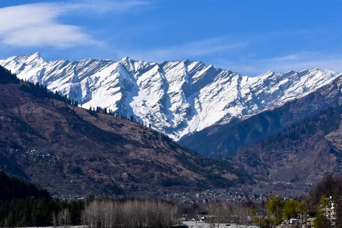
The term Biodiversity was coined first in the eighties of last century. It signifies totality of genes, species and eco systems in a region. Significance and richness of the Himalayan Biodiversity stands apart and same has been comprehensively researched.Vast, rugged, yet pristine Himalayas stretch over 2500 kms from Jammu & Kashmir to U.P. to Arunachal Pradesh. It has remarkable biological and cultural diversity, umpteen flowering plants(several endemic to region), over 800 tree species and more than one thousand medicinal plants.
The North East region alone takes pride in having 850 bird species, of which Sikkim has 552. Sikkim also accounts for 50 percent of Butterflies found in the whole of Indian Sub continent and takes pride in being repository to over 500 exotic orchids, 50 Rhododendrons,104 rivers and rivulets and more than 200 clean water lakes.
Botanically, Sikkim is richest as so much of Biodiversity is not found anywhere in world in a small area of 7096 Sq. Kms.This tiny state has all five climatic zones from an elevation of 285 metres to 8546 metres.
Need for Adequate Protection
Aren't we supposed to ensure adequate protection to such a valuable treasure of Biodiversity and maintain the productive capacity of the Eco System, apart from adding to the tree canopy and recharging the water bodies ?
Ecologically fragile Himalayan regions having a plethora of plant & animal biodiversity, traditional knowledge systems and sustainable livelihood practices need our continuous and consistent attention.The manifest threats from natural calamities called landslides, floods, flash floods, cloud bursts etc. cannot be ignored in highly sensitive regions of Western and Eastern Himalayas, from Seismic threats point of view.There is, therefore, a fervent need to do all that we can, for protection and preservation of Himalyan Ecology and livelihood patterns.
Greed, Not Need
To satisfy our greed not need, more specifically, adoption of quick fix, short term remedial measures have been playing havoc with mountain eco systems atleast since 2010.
Natural calamities in Ladakh, J &K(Kishtwar)H.P., Uttarakhand (Kedarnath Cloud Burst & heavy rain triggered Landslides),North Bengal (Teesta Overflow & Peculiar Landslides) and Sikkim (Earthquakes, GLOF & Landslides), go on to prove how we ignore onslaughts in the name of Himalayan Tourism & Char Dham visits in particular and developments of different 'shades' in general.
Unwanted Biotic Interference
As Himalayas are young and relatively fragile, Geological formation, due care and caution has to be taken especially while building roads, colonies, water supply, hydel power projects etc.
Parameters and standards suitable for plain areas and sea coasts can not and should not be applicable to any of the 8 Himalayan states.Threats keep cropping up when we play with nature knowingly and out of compulsion. Based on my personal field experience gained in two states, it could be stated that any crack or damage on top becomes a threat to survival of glaciers, rivulets, lakes and rivers. Both push and pull factors ensure unwanted Biotic interference.
Calamities Since 1988
It has been observed that natural calamities, basically large scale happenings of adverse nature result from earthquakes, glacial lake outburst floods, flash floods, cloud bursts, land slides and above average rainfall. Quantum of these has been showing upward trend since 1988.
We may pinpoint following major episodes briefly prior to analysing details.
1-EARTH QUAKES IN SIKKIM
Though Sikkim is an Earthquake prone area, recent ones took place in July 1988, September 11, 2011 and on the same date and almost same time in the evening in September 2012. First two shook and shattered the state and resulted into a number of casualties (50) and injuries, apart from wide cuts in the State Highways and damaging vital bridges in three out of the then four Districts. Narrow village roads, footpaths and Jeeps too suffered immensely. The last Earthquake, however, did not lead to any damage.Yet high degree of alert was maintained in the State for a month or so. As Sikkim lies in Zone IV and V, earth quakes low on Richter scale keep happening.
It may be worthwhile to note that during the Earthquakes of 1988 and 2011, no rescue and relief work could be carried out from evening to next morning due to lack of electricity. Presently artificial light can be created by the NDRF or SDRF teams, so many lives not only can be saved in darkness but seriously injured can be also quickly identified for transfer to nearest medical facility.
2-U.T. OF LADAKH
Though very little rainfall takes place in this newly created & beautiful U.T.(having only 3 Districts), natural calamities have been happening for some time. In recent months, both Cloud bursts and Flash flood incidents have been reported in this era of Global Warming and Climate Change. Some international border areas of Ladakh, in addition, have to also remain on high alert owing to persistent threats from China.
Afterall Galwan battle had taken place herein only six to seven years ago. In the recent past, Kargil-Leh Highway has been closed more than once and natural calamities too have happened in Kargil proper. In the same way, a village around Pangong Lake or Pangong Tsu was hit by flash flood. As population is not dense, impact of any natural event is not felt that much but isolation and remoteness factors also pose other problems. When weather is not congenial for an air lift in an emergency, communication through roads has to be resorted to in Ladakh. Hence, maintenance and repair of State and National Highways get primacy.
3-JAMMU & KASHMIR (Floods of 2014)
Generally large spread out floods don’t take place in level lands, such as, Srinagar. But these devastated many parts of U.T. in 2014, killing people, devastating houses, Shikaras, Houseboats, markets, vehicles and roads. Tourism suffered badly and for a long duration. In a way, it was an advance warning for natural calamities to take place in future.
Again both 2024 and 2025 have been tough for the U.T. from natural calamity point of view. During annual Amarnath Yatra, rain and snow, slippages, as such, pose difficulties to the pilgrims, apart from occasional danger from terrorists.
PAHALGAM
Pahalgam area of the state has also become vulnerable from physical threats and communication challenges as April 22 gruesome incident would reflect. Afterall, for no fault of theirs, 25 Indian tourists and one from Nepal were mercilessly killed by Pak terrorists. Names of only a few victims and perpetrators were divulged. What do authorities gain on being tight lipped on such grim happenings, perhaps only they would know. Transparency, however, always pays.
RAMBAN
Ramban District, a crucial location on National Highway 44 terminating at Srinagar is a crucial link of mountains and lakes of Kashmir valley with plain areas of Jammu.
J&K, reputed to be a paradise on earth, is also grappling with tremendous to excessive rainfall. One village of Ramban received Cloud Burst or heavy rainfall and hailstorm at 3 a.m. on 19th July which subsequently caused landslides, floods and sweeping of several houses and shops. Many local Nallahs also began overflowing. Five persons lost their lives initially and over 100 people were taken to safe places.
The incident also created a jam of 10 to 12 kms on the N.H.Total ten houses were completely crushed while forty were damaged. Villagers were so scared that sleeping at night was disturbed out of fear of landslide or flood.
After such happenings, District administration was on high alert.Truck Drivers going to Srinagar from different parts of country suffered maximum losses as they had to struggle even to get one meal and their important papers and bills were lost or misplaced due to crisis at Ramban.
KISHTWAR
Cloud Burst again hit remote Chosti village in Paddar area of J & K 's Kistwar District on the eve of 79th Independence Day. According to initial reports, over 65 persons expired, more than 100 were injured and 100 plus were reported missing. Unfortunate incident took place during annual Machail Mata pilgrimage, for which Chosti is the interim point, wherein Yatris can park their vehicles prior to resuming their journey on foot. District administration with SDRF and Army swung into action to begin picking up injured and held up, thus supervising rescue operations at the drop of hat.
Survivors recalled that ill fated site was covered by slush, boulders and uprooted trees. When pilgrims were teeming with chanting, all were swept away. Such was the power of gushing water that muck, stones and uprooted trees appeared in a large area to damage several houses.Those sitting at the Langar(community kitcen), enjoying the beautiful nature and a CRPF camp were swept away. It was learnt from locals that casualties could have been higher but the boulders swept down by the ferocious flood prevented water from entering Chosti village.
More caution will have to be taken by the District administration during Machail Yatra as fifteen to twenty thousand yatris were, in all, going to participate. Biggest challenge is to trace the bodies as a few might have been burried under the mounds of debris. Continued spell of inclement weather was proving to be a stumbling block in relief & rescue operations.
KATHUA
Seven induduals were killed in Jodh Ghati and Bagra villages of Kathua in a fresh incident of Cloud Burst. While a few houses came under the grip of flood, many were damaged together with vehicles. While Ujh river are flowing above danger mark, Railway traffic between Kathua and Jammu was also also disrupted.
4-HIMACHAL PRADESH
H.P. is not as infamous as is Uttarakhand in terms of occurence of natural calamities or for that matter, quantum of rainfall. The state is also more stable as compared to Geological formation of Uttarakhand and Sikkim.Stable and wide approach to Shimla from Kalka side is site to see and appreciate.
Three Distrcts of H.P. came in the severe grip of Cloud Burst resulting into death of over 240 persons and estimated loss of Rs 2 thousand Crores. The tragedies began with remote Kinnaur and Lahaul Spiti Districts, then gradually took Jakhu in Shimla District and Shrikhand area in Kullu District under its grip. Many people died and houses were swept away in Kullu.
In Kinnaur, mishap happened when labourers working on construction of a road of ITBP were trapped under a Cloud Burst.Two hundred of them could be rescued while 500 of them were still trapped.
Interestingly, It was gathered that Cloud burst had also taken place in the areas, wherein no clouds were witnessed.
In a latest development, since rain has begun playing villain again, eight to nine Districts of the state have been put on alert.
5- MEGA CLOUD BURST AT KEDARNATH SHRINE (UK)
The Kedarnath, one of the holiest temples under the exalted category of Four Dhams (Shrines) is located at the confluence of holy Mandakini and Saraswati rivers.The largest natural calamity after infamous Tsunami of December 2004 shattered this place from June14 to 18, 2013 when devastating and very scaring landslide and flood was ignited by excessive downpour (385 m.m.) or Cloud burst. This ferocious development led to over 4000 deaths, killing of animals(mules & ponies)and destruction of roads, footpaths, dwelling units and other properties on a large scale. Approaches to the temple were all cut off in a confirmed "Rain Prone" area and adjoining rivers also faced high erosion. Not only this, debris from the flood blocked the rivers.
Nonetheless, nothing happened to the main shrine of Lord Shiva in the same way as Jagannath Puri temple gets saved each time a Cyclone or Earthquake hits its vicinity.
In regard to Baba Kedarnath also owing to his supreme divine powers, time tested and highly durable ancient architecture and masonary work of the 1500 old temple , built by Adi Shankaracharya, vagaries of nature come and go but nothing happens to the World famous seat of Hinduism.
Tragedy struck the shrine area during a very busy travel and pilgrimage season. Also impacted were Gangotri, Yamunotri and Badrinath.This kind of rain and 'sweep' not only took Mandakini river valley under its grip but altogether 13 Districts of Uttarakhand had to face worst kind of devastation.Other Districts were : Bageshwar, Rudraprayag and Uttarkashi.
One Vandana Sharma 'Diya' has done a comprehensive study of Kedarnath tragedy and post calamity Eco conscious development.
Remedial Measures
Though a sizeable sum of money has been sanctioned by the Government of India for relief, restoration and eco development of the entire complex of Kedarnath, following Remdial Measures need to be also taken on Priority :
*Sustainable travel and pilgrimage tourism has to take the place of haphazard tourism dominated by middlemen and tour operators. Such work should be transparent with an element of accountability,
*Aesthetic & well ventilated housing and reasonable accommodation for pilgrims should be arranged to take place of unmindful and crammed up dinzy structures,
*State Government needs to pull up its sleeve in view of setback from natural calamities.Current casual approach has to be given up to make way for more responsive administration,
*A serious thought has to be given to take suitable steps for Waste Management. It is likely to improve health of temple employees and hawkers selling things needed by devotees to perform Pooja at the shrine,
*Preparation of a Disaster Risk Reduction Plan and an Evacuation Plan will be in fitness of things. It will be useful on the eve of Monsoon and help a great deal when unusual and heavy rush of pilgrims is likely to complicate things
TUNNEL TRAGEDY
This tragedy of Chamoli District led to unfortunate death of 200 persons on February 7, 2021. It killed 200 workers and others stuck inside an under construction long tunnel of Tapovan Vishnugarh Hydro Power Project in Chamoli District.
Patience, tolerance and perseverance of trapped persons and that of rescuers & medical team not only entered record books but it also set new bench marks. Rightly it sent shockwaves all over.
Gently pushing water, liquid food and Bananas through narrow pipes and day today effort at rescue was shown live on television but despite all this, trapped men could not be saved.
6-EXTREME RAINFALL FROM JUNE 15-17, 2013, AND THEIR IMPACT IN UTTARAKHAND
Uttarakhand having a population of 10.12 millions (2011 Census) and eight mountain and four plain districts is a pristine but ecologically fragile land, at the same time. Over last two hundred years large scale deforestation, construction of dams, roads and dwelling houses etc. have been noticed. It is a disaster prone (earth quake prone) area, figuring both in Zones IV and V.
Land slides, floods, flash floods and forest fires keep taking place.It has a large percentage of migrant labour from other states as also Nepal.
Forecasts & Actual Happening
In view of past , a forecast of heavy to very heavy rainfall on June 14, 2013 was made. Subsequently, forecast on June 15 for similar rainfall from June 16 to 17 and normal rainfall from June 18 to 19 was also made.
According to a comprehensive Study entitled "Uttarakhand : Development and Ecological Sustainability" conducted by Ravi Chopra, extreme rainfall from June 15 to 17, 2013 led to floods and landslides in several places. It was the worst disaster of the newly formed state.
Six thousand persons were either dead or missing. It included pilgrims and tourists from different states of India. Animals too perished on a large scale. Revenue loss only from tourism was to the extent of Rs 120 Billions during 2013-14 and Rs 200 Billions during 2014-15.
Besides challenges on the vital ecology and livelihood fronts, the state shall have to review its power development policy immediately. Signing of a record number of agreements for hydel power plants has given the state a bad name.
Economic development measures should be such that they maintain the ecological balance and donot, in any way aggravate the impact of a natural calamity.
DHARALI DEVASTATION
In view of the fact that recent Dharali devastation has led to missing of 60 numbers of migrant labourers, Sri Chopra has suggested that basic human resource and human conditions of migrant labour from other states and Nepal need special attention.
Early warning systems need to be provided or to be spruced up if already in place.There also has to be sufficient and fool proof preparedness for any possible disaster, afforestation in fragile zones and reasonable livelihood development.
As regards suggestion for good governance, it is a routined one. It does not cut any ice.
GLACIAL LAKE OUTBURST FLOOD IN SIKKIM
A very dangerous happening triggered by Glacier Lake Outburst Flood in the basin of fast flowing Teesta river rattled whole of Sikkim on October 23, 2023. By the time the manpower incharge of Teesta Stage III 1200 MW hydel power project dam at Chungthang Sub Division were alerted, the unprecedented outburst of river finished half of the dam.Since height of dam was relatively low, water did not enter the town area.
Overflow of South Lhonak Glacial lake located above Mukuthang at an altitude of 15,500 ft. in Mangan District, caused this unthinkable but once anticipated tragedy. This writer had cautioned on a few occasions, concerned state Department and Ministry of Central Government in the meetings & discussions.
About 200 persons, houses, roads & footpaths close to river banks were simply swept away in minutes between Sankalang in Mangan District and Melli in Namchi District. A new arched bridge over Teesta at Singtam too" blew out of winds". Its effect was also visible in lower portions of the river in North Bengal.
200 kms of area was severely affected but bountiful Govt.of India spared only a paltry sum of Rs 50 Crores to take care of rescue, relief and compensations.
It raised many pertinent questions from upkeep of ecology angle in the backdrop of continuance and fresh construction of several hydel power projects in Sikkim, North Bengal, Uttarakhand and H.P.
7-Teesta Floods and Landslides in N. Bengal and Sikkim
Whole of Sikkim STATE is being catered to by N.H.10, only one National Highway since 1975 which passes on both sides of beautiful, yet mighty & calamity- prone Teesta river. An alternative N.H.(180 kms) on the other bank of Teesta is under "construction" by NHIDCL for over 8 years. No body knows its completion date.Its silver line being- it passes through relatively stable areas vis a vis N.H.10.
Darjeeling, a District H.Q. & Queen of Hill Stations, has five roads leading to it, including a National Highway. Its Toy train from Siliguri having a tag of World Heritage is an additional feature.
On the other hand, Kalimpong District of West Bengal has access to plains in Siliguri and Bagdogra Airport, courtesy two highways, one of which via Lava, is never impacted by vagaries of nature.
Based on my own experience of this tough region for over 35 years, I may say that N.H.10 from Rangpo in Sikkim to Sevoke in North Bengal (60 kms out of 112 kms distance to Siliguri) has been "fathered" by atleast three road agencies one after another. Without any doubt, it has been happy hunting ground for landslides and sunk and degraded portions of land of all sorts.
Till 1993, if I recall, it was a narrow road or a confirmed apology to a National Highway. Landslides were more and persistent between June and October, when sufficient percolation of water would take place into the steep land mass.Trans-shipment phenomenon, therefore, was all pervading.
One Road, Many Guardians
Border Road Organisation used to look after this stretch in its own planning & narrow perspective way. But it used to have Dett.or Detatchments at frequent intervals.These would swing into action during a rock fall or bigger sliding of fragile hill sides.This kind of Detachment or presence of Gangmen was completely lacked by West Bengal PWD which took over N.H.10, perhaps in 2012.
Modus operandi of slow and less responsive West Bengal PWD was God forsaken from their "regional office" based in Kalimpong. A couple of times PWD Secretary would not respond even to my telephone calls.Once in Delhi for a meeting, I used Cell phone of his senior to speak to him about need to improve bad condition of the highway.
40 kms of Sikkim portion was handed over to Sikkim PWD for maintenance & minor repairs. But their performance too was below par especially during heavy downpours when shooting stones would come down like bullets from a gun.They lacked necessary trained manpower and machineries, apart from skill and experience to tackle increased workload, all of a sudden.
National Highway and Infrastructure Development Corporation
For the last few years NHIDCL has been sole guardian of the entire 112 kms stretch of road from Gangtok to Siliguri. Apart from introducing upgraded and new machineries, cranes and JCB's coated with professionalism, their best achievement till date has been construction and commissioning of a Via duck and bye pass at Rangpo.This was inordinately delayed due to non commitment and casual attitude of Government of West Bengal as regards vacation of land in their territory by unauthorised obstinate settlers.
Changing Scenario
One feels sorry to state that width of N.H.10 has increased over the years and trans-shipment of yesteryears has almost gone into oblivion, due to rise and rapid movement of traffic and mushrooming of constructions along the N.H.
However, unjustifiable and beyond the carrying capacity pressure also on land has risen manifold.
If domestic tourist arrivals (10 lakhs per year, more than SIikkim's population) add to GDP and Per Capita Income of Rs.7 lakhs 7 thousand & 18 of Sikkim, this comes with a cost. Over exploitation and virtual sacrilege of fragile land mass in many places is playing havoc. One sees challenges in respect of traffic, water supply, electricity, waste management and climate change. If there is land slide in majority of the areas, there are also incidences of sinking zones. Needless to say, insistence on constructions therein prove fatal.
On top of it, during the current Monsoon season, say since May, Teesta river is in massive spate after many years, thus partially submerging Teesta Bazar township. It may be noted that main concrete bridge commissioned in 1995 is the fifth one. Its four predecessors have been swept away starting from thirties of last century.
A steep narrow road from T. Bazar to Darjeeling has been also cut off for more than 6 weeks. It is not only weakening of the hills but loss of substantial livelihood which needs to be addressed on priority.
Not only purchasing power of area people has been substantially reduced, left over masses also live in a state of perpetual tension on account of changing "mood" of the river. Some donot even sleep at night like a Lepcha woman at Dikchu.
Incidentally, people living between T. Bazar in West Bengal and Melli on South Sikkim side and Melli on W. Bengal side have no "Mai Baap". People of Teesta Bazar and Melli on W.Bengal side depend heavily more on tourists and rafting enthusiasts, than on occasional "local" vehicles. And when Teesta river submerges N.H.10 several times, livelihood of the people goes for a duck. For the last three days N.H.10 has been closed again for the sixth time. It also had to be closed for unhindered Landslide clearance on a sunny day by heavy machineries few times in the last two months.
To add further insult to the woes of people, suppose river bank in Melli of Sikkim and its counterpart in West Bengal get impacted by Teesta, people of West Bengal get only half of compensation from their State vis a vis what is given by Govt.of Sikkim (Rs.Fifty thousand in Bengal but Rs.1.25 Lakhs in Sikkim)
Activation of “Dormant” Slide Points
Apart from emergence of fresh Landslide points, old and vitually dormant landslides at Lekobir, Birik and Sirwani have got reactivated. Whereas 5 to 6 layers of Ranrang slide at Mangan have been settled in 1991, most difficult 9th Mile slide and sinking zone near Ranipool has been set right by application of fresh knowhow and planting of a special grass by BRO.
I vividly remember walking two kms in slush as an I.A.S. Probationer below the Lekobir slide in October,1985 to the then vibrant Teesta.Bazar, when Trans-Shipment did not materialise.
When Seti Jhora slide somewhat close to Coronation bridge emerged, say, seven years ago, it would not be worrisome initially, as it was in hard rock area like Birik slide. A new slide called Selfie Dara near Seti Jhora too poses difficulties off and on. Not only at Seti Jhora but elsewhere too, on the N.H., sufficient width has been created over the years which makes One Way Traffic possible but only during the day. But risk is yours.
There is no end to saga of landslides when you live in Sikkim or Kalimpong.
When relatively new slide point above Coronation Bridge at Sevoke is controlled and traffic resumes, one should not be surprised if due to sharp erosion of Teesta at 29th Mile, traffic comes to a screeching halt. Some other slide points viz, Gail Khola, Kirney Khola and Bagey Khola too trouble road users anytime during the Monsoon, which has been very heavy so far.
Shall We Say:
An average Sikkimese is perpetually sandwiched between Slide Land and Bengal Land.
DHARALI CALAMITY
A lot has been written, told, telecast, seen and discussed about massive flash flood in Kheer Ganga river at 1.45 hours in the afternoon of August 5. Flash flood was possibly caused by heavy quantum of rainfall at 6,700 feet, seven kms up from Dharali.
Leaving aside picturesque and pristine Dharali village (having attractive two storeyed wooden houses,one reportedly 800 year old), commercial pocket which had mushroomed bereft of any planning having over 30 hotels and homstays, sufficient road and parking space, WAS SWEPT AWAY or damaged beyond repair. Villages of Harshil and Sukki too suffered.
Rummaging for bodies etc through mounds of muck and debri of the the height in the range of 20 to 80 feet is a herculean task. It is happening every day.
So far only four persons have been reported dead and 66 are still missing. Their break up being : 25 from Nepal, 13 from Bihar, 8 each from Dharali and U.P.,7 from Rajasthan and 5 from other parts of Uttarakhand. Missing lot includes 8 persons from one family of Nepal.
It is a hope against hope scenario after twelve days of catastrophe.
There are reports that no effort, whatsoever, is being spared by the dedicated manpower of the State Government and para military forces.
Daily search is being undertaken with the help of a hand held machine which is supplemented by a battery of trained and experienced Sniffer dogs of Army.
Dedicated and disaster management trained personnel of SDRF, NDRF, ARMY, ITBP and BRO have taken up a herculean task in this acute hour of crisis. Support from Helicotors is also being taken to operate as many sorties as possible to take needy and sick people to District hospital, Uttarkasi and AIIMS, Dehradun. In addition doctors and specialists have been also deputed to disaster zones. Also additional allocations of Diesel and LPG have been made. It will help both the rescue teams and the common citizen.
More or less connectivity to Dharali has been restored and a few irritants on the roads, such as, sinking points, rock blockages and clearance of rubbles and debris have been taken care of.Construction of a 90 feet Bailey bridge by the BRO between Gangnani and Harshil in a record three days has been one of the most notable and appreciable achievements.
In a welcome development, a channel has been made on 15th August to release water from an artificial lake formed after August 5 calamity.
Viable and Doable Suggestions
Following MEASURES would be required on PRIORITY
*People residing along river banks in Uttarkashi, Gangotri, Bhatwari, Maneri, Rudraprayag or similar vulnerable locations in other states shall have to be shifted to safe locations.In a fresh development, a few residents of Dharali have expressed their wish but they have demanded more financial assistance from the Government, which is yet to be responded to,
*In view of fragility of the belt, insistence on a fixed width of a highway is not needed. Idea is to have a passage, not fast one to attract an accident,
*There should be no scope for unmindful and unregulated construction of any kind,
*Concern shown towards shortages & hoarding tendencies in the middle of a calamity may have to be encouraged,
*Tree plantation as a tool to maintain ecological balance should be propagated and pursued. These shall have to be watered and regularly attended to,
*For tackling natural calamities there has to be a long term plan.Same shall have to be reviewed from time to time by authorised persons,
*Waste Management is a necessity. Only after segregation garbage has to disposed off. These should not be dumped, however, into waterfalls and rivulets. Use of polythenes shall have to be banned and enforced,
*Preparation of a Disaster Risk Reduction & Evacuation Plan would be necessary,
*Casual approach of the Government has to be replaced by a proactive, people centric one.
To Sum Up
No calamity happens in isolation.These are very much part and parcel of prevailing surroundings. Why only mountain eco systems of two Union Territories and six states, one is witnessing devastating scenes in Delhi, Gurugram, Dehradun, Patna, Ranchi and Guwahati as well. A few days ago Rupa river too was overflowing in Barbani and Rajpur areas of M.P.
At a time when hill people are screaming, plainsmen are having unimaginable fears owing to overflow situation. As humans hold the key, it is incumbent upon them to wake up and take viable steps. In the reverse scenario, generations will come and go but situation may remain unchanged.
(Author, a former civil servant, has served as Chief Secretary of Sikkim.)









[[comment.comment_text]]