Ballari’s Mining Disaster: From Institutional Capture to Real-Time Accountability

 an hour ago
Ballari: The Rise of Unchecked Mineral Extraction
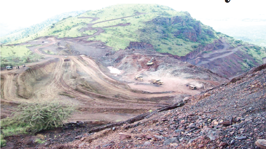
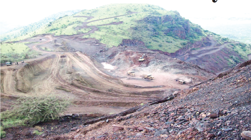
While mining in Kudremukh ended under judicial direction, the iron ore-rich districts of Ballari, Sandur and Hospet witnessed a very different trajectory during the commodity boom of the 2000s. Rising demand for iron ore, driven partly by rapid industrialisation and infrastructure development, encouraged the expansion of mining operations across the region.
The scale and character of extraction raised serious concerns about regulatory oversight. Numerous operations were accused of violating lease boundaries, disregarding environmental safeguards and exploiting weaknesses in administrative monitoring. The region came to symbolise a wider problem: the concentration of economic and political power around mineral extraction.
The environmental consequences extended beyond the immediate mining sites. Heavy truck traffic damaged roads, increased dust pollution and created safety hazards. Excavation and the removal of vegetation exposed fragile hillsides to erosion. Sediment and mineral fines entering streams threatened the Tungabhadra catchment, raising concerns about reservoir capacity, water quality and downstream irrigation.
These impacts were not simply the unavoidable costs of mining. They were intensified by inadequate monitoring, weak enforcement and failures to ensure that operators complied with the conditions governing their leases.
The episode also exposed the dangers of regulatory capture. When powerful commercial interests acquire political influence, enforcement agencies can find themselves unable to perform their statutory duties independently. Transfers of officials, delays in investigations and inconsistent action can undermine the credibility of the entire regulatory system.
The Karnataka Lokayukta’s investigations and subsequent inquiries by the Central Empowered Committee brought the scale of the controversy into sharper focus. In 2011, the Supreme Court imposed sweeping restrictions on mining in the region, followed by a regulated framework for the resumption of eligible operations.
Judicial intervention became necessary because the ordinary mechanisms of administrative oversight had failed to contain the damage in time. By then, ecological degradation, infrastructure damage and the loss of public revenue had become major concerns.
The central lesson is that a regulatory system cannot be judged solely by the strength of its laws or the severity of its eventual punishments. Its effectiveness depends on whether violations are detected promptly, evidence is preserved and corrective action occurs before environmental damage becomes irreversible.
Cartographic Ambiguity: When Boundaries Become Vulnerabilities
The Ballari controversy also illustrates how uncertainty in maps and land records can create opportunities for exploitation.
Where interstate boundaries pass through forested and mineral-rich terrain, discrepancies between historical records, topographic maps and physical boundary markers can complicate the enforcement of mining leases. A line depicted on a map does not necessarily establish the precise position of a boundary on the ground, particularly when the map itself identifies the need for field verification.
The account of mining along the Karnataka–Andhra Pradesh border highlights allegations that inadequately verified boundary lines and the disappearance or disturbance of older markers were exploited to justify extraction beyond authorised areas.
The lesson is not that cartographic records are inherently unreliable. Rather, maps must be supported by authenticated coordinates, physical demarcation and regularly updated land records. Where substantial mineral deposits lie close to a state boundary, uncertainty should trigger more rigorous scrutiny, not become a reason for postponing enforcement.
A coordinated system involving the Survey of India, state forest departments, revenue authorities and mining regulators could reduce such vulnerabilities. Digitised cadastral records, geographic information systems and satellite imagery can help identify discrepancies between approved lease areas and actual extraction.
However, technology alone cannot resolve disputes over jurisdiction or ownership. Digital maps must be supported by legally authenticated boundaries, independent verification and transparent procedures for resolving objections.
The Sandur Question: Incomplete Notifications and Legal Uncertainty
A related issue concerns the historical transition of forest administration following the integration of the former princely state of Sandur into the Indian Union.
The account examined in this paper describes uncertainty surrounding the completion of statutory procedures for declaring certain lands as reserved forests. Where preliminary notifications existed but final declarations or settlement procedures remained incomplete, questions could arise about the precise legal status of particular tracts.
Such uncertainty can complicate enforcement, especially when commercially valuable mineral deposits are involved. Yet the existence of an incomplete notification does not automatically establish that land is free from forest protection. Its legal status must be determined from the applicable statutes, historical records, subsequent government orders and judicial decisions.
The Supreme Court’s landmark T. N. Godavarman Thirumulpad forest case established a broad approach to identifying forest land for the purposes of conservation law. Nevertheless, the application of that principle to a particular parcel requires careful examination of the relevant legal and factual record.
The broader administrative lesson is clear. Governments must resolve historical ambiguities before they become opportunities for competing claims. Forest notifications, village rights, lease boundaries and land classifications should be digitised, reconciled and made publicly accessible. Mining approvals should not proceed on the assumption that uncertainty will eventually be resolved in favour of extraction.
The Failure of Enforcement
Karnataka’s mining controversies cannot be explained simply by gaps in legislation. The state possesses statutory mechanisms to regulate mineral extraction, protect forests and control pollution. Their effectiveness, however, depends on coordination and enforcement.
Mining authorities must ensure that operations remain within approved boundaries and comply with lease conditions. Forest officials must protect notified forest areas and prevent unauthorised occupation. Pollution control authorities must monitor emissions, discharges and damage to water bodies. Revenue departments must maintain reliable land records.
When these responsibilities are divided among institutions that fail to share information or act independently, violations can persist despite a substantial legal framework.
The problem becomes particularly acute when officials face political pressure or when enforcement decisions threaten powerful commercial interests. Transfers, delayed approvals and selective action can weaken institutional independence. Investigations conducted after the event may establish wrongdoing, but they cannot restore destroyed hillsides or fully reverse damage to a river catchment.
The resulting pattern is one of post-mortem governance: authorities act decisively only after ecological harm has become too visible to ignore.
A New Agenda for Environmental Accountability
Future environmental governance must move from reactive litigation towards continuous monitoring and early intervention. Judicial review remains indispensable, but courts should not have to substitute repeatedly for routine administrative enforcement.
First, establish independent satellite-based monitoring. Publicly accessible geographic information systems should track changes in forest cover, mining boundaries and land use. Satellite observations must be periodically verified through field inspections and linked to official lease records. Significant deviations should trigger mandatory investigations.
Second, strengthen financial accountability. Banks, investors and public financial institutions should incorporate environmental compliance into project assessments and ongoing lending decisions. Independent audits, transparent beneficial-ownership records and enforceable disclosure requirements can help identify risks before they become major liabilities. Financial pressure must operate within the law and follow established procedures.
Third, monitor mineral transport and supply chains. Digital transit permits, vehicle tracking, weighbridge records and electronic reconciliation of mineral production with dispatches can help detect discrepancies. Community-based water-quality monitoring and independent environmental audits should complement official inspections. Evidence must be collected lawfully, securely preserved and made available to authorised investigators.
Fourth, protect regulatory independence. Transfers of officers engaged in sensitive enforcement work should be transparent and subject to appropriate safeguards. Regulatory decisions, inspection reports and reasons for delayed action should be recorded and disclosed wherever legally permissible. Officials must face proportionate accountability for proven misconduct or dereliction, while retaining protection against arbitrary punishment for bona fide decisions.
Fifth, involve local communities. Forest-dependent populations, farmers and local institutions often observe environmental changes before distant regulators do. Accessible complaint mechanisms, public hearings and community monitoring can improve early detection. Participation must be meaningful, rather than a procedural formality after the principal decisions have already been made.
Generation Z and future environmental advocates can contribute by developing open-source monitoring tools, examining public records and collaborating with scientists, journalists and local communities. Their role should be to strengthen evidence-based accountability, not to replace professional investigations or lawful regulatory processes.
From Post-Mortem Governance to Prevention
Karnataka’s forest and mineral governance history exposes a profound contradiction. Public forest lands can remain tied to economically distressed industrial enterprises, contested projects can be left to collapse without a coherent policy resolution, and technologically advanced operations can be terminated without a wider strategy for applying their useful lessons. At the same time, poorly regulated private extraction can inflict extensive damage before effective intervention occurs.
These outcomes suggest that environmental governance is undermined not only by inadequate rules but also by inconsistent priorities, institutional fragmentation and failures of accountability.
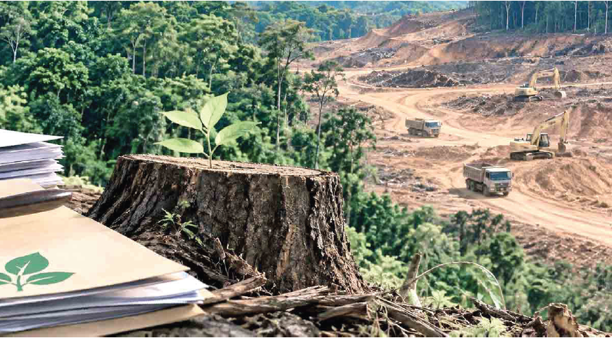
The way forward requires an administration that treats ecological protection as a continuous responsibility rather than an emergency response. Reliable maps, transparent records, independent regulators, financial scrutiny and real-time monitoring must work together to prevent violations before they become disasters.
The ultimate test of governance is not how forcefully a government responds after a forest has been damaged or a river catchment threatened. It is whether the institutions entrusted with public resources can detect danger, act impartially and protect the common good in time.
Karnataka’s experience should therefore serve as a warning and an opportunity: replace administrative inertia with preventive oversight, and ensure that the protection of forests, water and community resources remains a central obligation of the state.
(Author, a former Deputy Chief Conservator of Forests in Karnataka, is a known expert on forestry, wildlife, and governance issues.)








[[comment.comment_text]]